


Garfield 24, Garfield County, Colorado
About
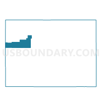
Outline

Summary
| Unique Area Identifier | 548224 |
| Name | Garfield 24 |
| County | Garfield County |
| State | Colorado |
| Area (square miles) | 1,242.57 |
| Land Area (square miles) | 1,241.75 |
| Water Area (square miles) | 0.82 |
| % of Land Area | 99.93 |
| % of Water Area | 0.07 |
| Latitude of the Internal Point | 39.53355950 |
| Longtitude of the Internal Point | -108.48737050 |
Maps


Graphs
Select a template below for downloading or customizing gragh for Garfield 24, Garfield County, Colorado


Neighbors
Neighoring Voting District (by Name) Neighboring Voting District on the Map
- Davis West Voting District, Uintah County, UT
- Garfield 20, Garfield County, CO
- Garfield 22, Garfield County, CO
- Garfield 23, Garfield County, CO
- Garfield 25, Garfield County, CO
- Garfield 26, Garfield County, CO
- Garfield 27, Garfield County, CO
- Mesa 1, Mesa County, CO
- Mesa 2, Mesa County, CO
- Mesa 36, Mesa County, CO
- Mesa 80, Mesa County, CO
- Rio Blanco 1, Rio Blanco County, CO
- Rio Blanco 2, Rio Blanco County, CO
- Rio Blanco 5, Rio Blanco County, CO
- Thompson Voting District, Grand County, UT
Top 10 Neighboring County Subdivision (by Population) Neighboring County Subdivision on the Map
- Fruita CCD, Mesa County, CO (23,655)
- Rifle CCD, Garfield County, CO (13,236)
- West Garfield CCD, Garfield County, CO (6,041)
- Uintah and Ouray CCD, Uintah County, UT (5,753)
- Meeker CCD, Rio Blanco County, CO (3,858)
- Rangely CCD, Rio Blanco County, CO (2,808)
- De Beque CCD, Mesa County, CO (934)
- Thompson Springs CCD, Grand County, UT (127)
- Uintah and Ouray CCD, Grand County, UT (0)
Top 10 Neighboring Place (by Population) Neighboring Place on the Map
Top 10 Neighboring Unified School District (by Population) Neighboring Unified School District on the Map
- Mesa County Valley School District 51, CO (143,321)
- Uintah School District, UT (32,588)
- Garfield School District RE-2, CO (25,009)
- Grand School District, UT (9,225)
- Garfield County School District 16, CO (5,935)
- Meeker School District RE1, CO (3,859)
- Rangely School District RE-4, CO (2,800)
- De Beque School District 49-JT, CO (921)
Top 10 Neighboring State Legislative District Lower Chamber (by Population) Neighboring State Legislative District Lower Chamber on the Map
- State House District 54, CO (86,291)
- State House District 55, CO (79,305)
- State House District 57, CO (78,537)
- State House District 55, UT (38,435)
Top 10 Neighboring State Legislative District Upper Chamber (by Population) Neighboring State Legislative District Upper Chamber on the Map
- State Senate District 7, CO (152,044)
- State Senate District 8, CO (148,629)
- State Senate District 26, UT (101,392)
- State Senate District 27, UT (93,972)
Top 10 Neighboring 111th Congressional District (by Population) Neighboring 111th Congressional District on the Map
Top 10 Neighboring Census Tract (by Population) Neighboring Census Tract on the Map
- Census Tract 9520.02, Garfield County, CO (8,075)
- Census Tract 15.02, Mesa County, CO (7,214)
- Census Tract 9521, Garfield County, CO (6,041)
- Census Tract 9402.01, Uintah County, UT (5,753)
- Census Tract 3, Grand County, UT (4,833)
- Census Tract 9511, Rio Blanco County, CO (3,858)
- Census Tract 18, Mesa County, CO (3,424)
- Census Tract 9512, Rio Blanco County, CO (2,808)
Top 10 Neighboring 5-Digit ZIP Code Tabulation Area (by Population) Neighboring 5-Digit ZIP Code Tabulation Area on the Map
- 81650, CO (13,006)
- 81635, CO (5,957)
- 81648, CO (2,808)
- 81524, CO (2,300)
- 81630, CO (979)
- 81525, CO (871)
- 84540, UT (46)